

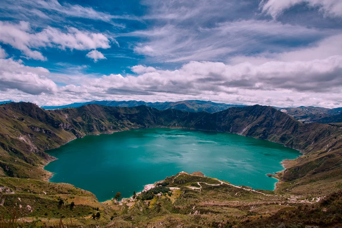
Some landscapes make an immediate impression, while others reveal themselves more gradually, and Quilotoa was both.
Quilotoa is a stunning 250-meter-deep, emerald-green crater lake inside an impressive 3-kilometer-wide volcanic caldera in Ecuador's Andes. It is in Cotopaxi Province, part of the Los Ilinizas Ecological Reserve.
It sits at roughly 3,900 to 4,000 meters (12,800 to 13,100 feet) above sea level. It formed about 800 years ago after a massive volcanic eruption collapsed the magma chamber.
When I first stood at the edge of the crater, I found it hard to take in how huge the place was. The lake lay in the large depression below, surrounded by steep volcanic walls that seemed to bend inward toward the water. Above the lake, the clouds kept moving across the sky, altering the light from one moment to the next.
What first struck me was the color. The water looked almost unreal, with a deep turquoise surrounded by darker slopes, muted greens, and exposed earth. Yet the longer I stayed, the less significant the color became; what interested me instead was the relationship between the lake and the structures surrounding it.
Quilotoa is not just a lake in the mountains; the water sits within the remnants of a huge geological event. Its calm, almost meditative appearance lies within a landscape formed by violence, collapse, and transformation. That contrast remained with me.
The layers, signs of erosion, and scars on the crater walls show processes that unfold over a time scale that is hard to comprehend. In contrast, the lake looks calm and as if it has almost no weight. Although stone and water share the same space, they seem to follow different rhythms.
One reason I keep being drawn to geological landscapes is that they make time visible.
In places such as Quilotoa, photography tends to shift from simply recording what is in front of the camera to focusing on how that scale is to be interpreted. The problem isn't locating something spectacular to photograph; the spectacle is already present. The problem is to simplify it.
I wanted the picture to keep the crater's open character and the lake's isolated position without turning the scene into a typical postcard. The sky became an important element in the composition since its movement and variation in density matched the irregular shapes of the crater beneath, while the water offered a visual break between the two.
As I looked through the viewfinder, I realized more and more that the human scale is very small in this landscape. The roads and paths around the crater can serve as a reference, but by comparison they are of little significance given the landscape's scale.
They remind us that our time here is temporary, while the geological processes that formed and continue to alter places such as Quilotoa act over centuries and millennia.
That idea is closely linked to much of my photographic work: landscape not just as scenery but as evidence. Evidence of time. Evidence of transformation.
Evidence shows that forms that seem permanent are, in fact, always changing.
Quilotoa left me with a mental image, but more than that, it reminded me why I keep going back to mountains, volcanic areas, and isolated landscapes. They slow our sense of time.
And sometimes, standing before them with a camera, that is enough.
